There
is more than enough information on Lee's Ferry to
write a book, and there are numerous books out there.
For the scope of this web page, I have to keep it pretty
simple, sorry! O.K. lets start with a short description
of the area.
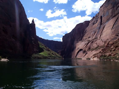
Lee's
Ferry is the only place in the Grand Canyon National
Park that you can drive right up to the Colorado
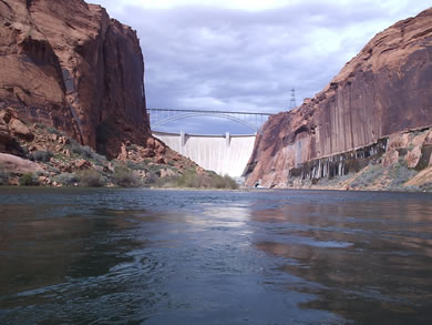
River. The stretch of the Colorado River between Lee's
Ferry and Glen Canyon Dam is part of the Glen Canyon
National Recreation Area and is maintained by the National
Park Service. The Grand Canyon begins at Lee's Ferry.
For an absolutely stunning 360 degree panoramo of Horseshoe bend Click Here
The
Campgrounds
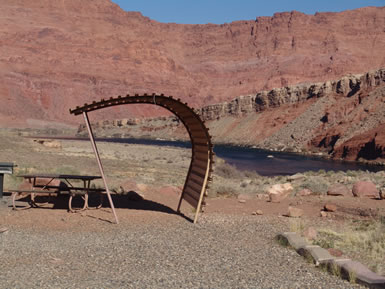
Located
about 1.5 miles back up the road from the boat ramp
is Lee's Ferry Campground. 54 well
kept but slightly unlevel campsites make up the campground.
There are flush toilets and a waste station for RV's.
There are even wind breaks in each campsite as the
wind can sometimes pick up pretty strong in the afternoons
(make sure you bring your stakes if you are tent camping).
Upriver
campgrounds
If
you have a boat, there are several dispersed campgrounds
available upriver. Armed with a map of the river (available
in Marble Canyon) and good directions of how to avoid
losing a prop in the shallow water of the Colorado River
(ask anyone in one of the local fly fishing shops), there
are campgrounds at 6 mile, 7 1/2 mile, 8 mile, 9 mile,
Ferry Swale and Ropes Trail (powerline camp). All of
the campgrounds are a few steps from where you anchor
your boat and are a good 10 feet above the waterline.
There are vault toilets available but you need to bring
your own water and trash bags. This is a PACK
IT IN - PACK IT OUT area. There is a big bonus
for camping upriver in that if you get up early enough,
you can beat the guides to their favorite fishing spots.
Fishing
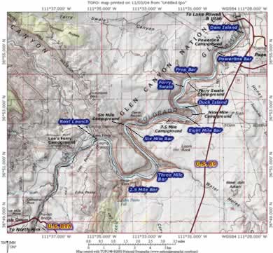
If
you like to fish for trout, This is the place to be in
Arizona for large trout. Technically more difficult to
fish than most places it is not too unlikely that you
might land a 20 inch plus rainbow trout. Some estimates
suggest that there are up to 40,000 trout per mile in
the canyon. See the map below for the most popular fishing
areas at Lee's Ferry. (Click Map To Enlarge)
From
Flagstaff, take I-40 east to Hwy 89 (Grand Canyon-Page
Exit). Travel 110 miles north on HWY 89 to the turnoff
to the Grand Canyon North
Rim, Hwy 89A. Turn left on Hwy 89A and travel for
15 miles to the Glen Canyon/Lee's Ferry Recreation Area
entrance just past the bridge over the Colorado River.
Turn right at the entrance and travel 5 miles to the
campground.