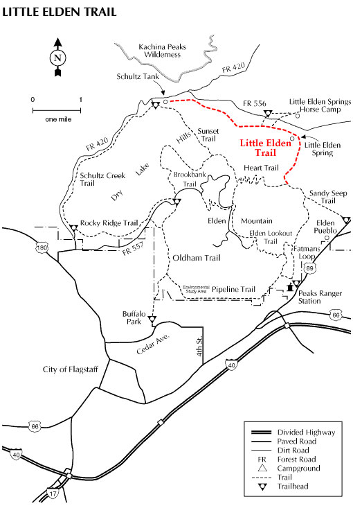
The Little Elden Trail begins within the boundaries of the City of Flagstaff, then leads the user into the heart of the Peaks trail system, at Schultz Tank. From this point you can connect to the Dry Lake Hills/Mt. Elden trails to the south, or the Kachina Peaks Wilderness trail system to the north.
The Little Elden Trail winds along the north side of Little Elden Mountain through stands of gamble oak and Ponderosa pine.
At a Glance
Usage:
Medium
Best Season:
April thru November
Closest Towns:
Flagstaff, AZ
Operated By:
Flagstaff Ranger District - 928-526-0866
General Information
Directions:
Elevation: 7,200' to 7,800'
USGS Map: Sunset Crater West
Location: 3 miles north of Flagstaff off US 180
GPS: N35° 16' 48.576", W-111° 35' 12.8034"
Access: Drive 5 miles northeast of Flagstaff on US 89. Turn west (left) on FR 556 and drive 2 miles to Little Elden trailhead located on the north (right) side of the road. Equestrian can park at the Sunset Trailhead or the trailhead just west of the Little Elden Springs horse camp on FR 556.
The trail may also be accessed from Schultz Tank or via the Sandy Seep Trail.
General Notes:
Rating: Easy
Hiking time: 2.5 hours
Area/Length : 4.7 miles
Latitude : 35.279995
Longitude : -111.586419
Elevation : 7235 at trailhead
Notes:
Mountain bikers and hikers should use this trail with caution, and always yield to horseback riders.
An equestrian water source is located at Shultz Tank.