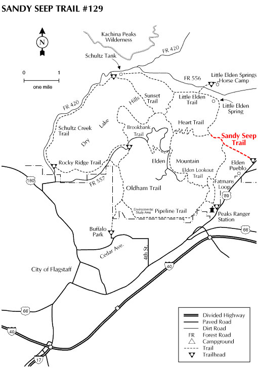
The Sandy Seep area on the eastern slopes of Mt. Elden is an important winter range for mule deer as well as a valuable recreation resource for the Flagstaff area. The trail that provides access to it follows an old jeep track that meanders through the open grasslands dotted with ponderosa pines, Gambel oaks and clumps of cliff rose.
To ensure that the area's recreational use does not impair its value as wildlife habitat, the Forest has closed the area to entry by motor vehicles. If you come under your own power or aboard a friendly saddle horse, however, you're welcome to enjoy the excellent views the area provides of Mt. Elden and the Sunset Volcano Field. And you'll stand a good chance of seeing some of the area's resident mule deer as they fade into the background.
As you hike you'll notice that Mt. Elden is covered with dead trees killed by a disastrous fire in 1977. Climbing higher you'll see evidence of the fire closer at hand including numbers of burned out snags as well as the remains of old fire breaks plowed into the landscape. Near the end of the trail you'll be hiking on land that was actually burned over by the fire. Here you can get a close look at how the area is naturally regenerating. Pioneer sprouts of oak at lower elevations and aspen higher up carpet the slopes. These lush green saplings provide nourishing browse for the area's deer herd and are creating a display of fall colors that becomes more magnificent every year.
Location: On the east side of Flagstaff, within the city limits.
GPS: N35° 14' 59.0994", W-111° 33' 43.3434">
Access: Take Highway 89 north east out of Flagstaff toward Page. One half mile beyond the Townsend/Winona Road intersection (a little over two miles north of the Flagstaff Mall) a short Forest Road (FR 9139) turns west off the highway. This takes you to the trailhead.
General Notes:
Rating: Moderate
Hiking Time: 1.5 hours round trip.
Area/Length : 1.5 miles
Latitude : 35.249442
Longitude : -111.561329
Elevation : 6885 - 7200
Notes:
No motor vehicles
The Equestrian Bypass of the Arizona Trail is now completed, signed, and open to the public all the way from Fisher Point to Sandy Seep Trail.