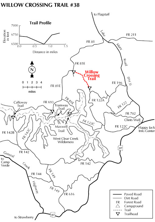
The trail starts at the end of FR 122A in a parklike setting of mature ponderosa pine. The trail heads northwest following the west side of a small drainage before descending into Willow Valley. Vegetation found along this stretch of trail includes ponderosa pine, locust, and Gamble oak. Once in the drainage of Willow Valley, the vegetation consists of more riparian species, including poison ivy. Learn to identify this three-leaved plant. Other riparian plants in the drainage include wild grape and willow. The rugged canyon of Willow Valley provides the required habitat for many species of wildlife, including the reclusive black bear. Look for signs of black bear activity such as torn-apart logs and overturned rocks.
The trail climbs gradually out of the canyon through an area of ponderosa pine and follows along the south side of a fence line to the trailhead on FR 9366M. Watch for the rock cairns that mark the trail through this stretch.
Rating: Easy
Notes:
High clearance vehicles are recommended and the road may not be passable during wet weather.
At a Glance
Open Season:
April
Closest Towns:
Happy Jack, AZ
Operated By:
Mogollon Rim District - 928-477-2255
General Information
Latitude: 34.621843
Longitude: -111.398129
Area/Length: 1.3 miles
Elevation: 6805
Directions:
USGS Maps: Calloway Butte
Location: Southeast of Flagstaff on roads that are either paved or graveled and suitable for passenger cars in most weather.
Access (south trailhead): From Clints Well (junction of Arizona State Route 87 and the Forest Highway 3) drive north on FH-3 approximately 4 miles to FR 196. Turn left (west) and proceed approximately 2 miles to FR 122A. Follow 122A to the trailhead at the roads end. Be sure to re-close the gate by Pecks Point Tank.
Access (north trailhead): From Happy Jack Ranger Station, follow Forest Highway 3 (Lake Mary Road) south 7.5 miles to Forest Road (FR) 81. Go right (west) on FR 81 and continue for approximately 5 miles to the FR 9366M. Go 0.3 mile to the traihead which is located on the left. *