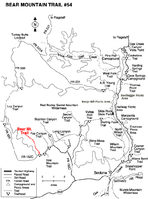
The hike to the top of the mountain is mostly unshaded, steep and difficult in places. Great views the whole way. The trail begins at a broad path at the parking area, crosses two washes and then starts a gradual ascent 1/4 mile to the wilderness boundary at the base of the mountain.
The trail narrows and begins a 450 foot switchback that is steep and rocky in places. It levels out following narrow plateau area and then begins a steep rocky 500 foot climb in a narrow side canyon to a broad plateau. It crosses the plateau gradually ascending, dips down, and then climbs another 400 feet to a false summit. Fay Canyon views are to the right (northeast).
The trail continues a moderate climb to true summit. There are great panoramic views here. Continue over level ground another 200 yards to the Red Canyon overlook and a view of the San Francisco Peaks in the distance to the north. Return by the same route. Do not attempt this hike when there is significant snow on the mountain.
.
Rating: Strenuous
Use: Moderate
Season: All year
Hiking time: 4.5 hours round trip
USGS Maps: Wilson Mountain/Loy Butte
At a Glance
Open Season:
Year 'round
Usage:
Medium-Heavy
Closest Towns:
Sedona, AZ
Operated By:
Red Rock Ranger District - 928-203-2900
Information Center:
Hiking only. Unsuitable for horses. No mechanized vehicles (including mountain bikes) in Wilderness. This trail can be hot and dry in summer. Please do not disturb ruins or remove artifacts.
General Information
Latitude: 34.893675
Longitude: -111.86543
Length: 2.5 miles
Elevation: 4605 at trailhead
General Notes:
Directions:
From the junction of Routes 89A and 179, take 89A west 3.2 miles to Dry Creek Road on the right. Go. 2.9 miles to a "T" and turn left on Boynton Pass Road. Go 1.6 miles to another "T" and turn left onto FR 152C. Continue for 1.2 miles to the trailhead parking area on the left. Cross the street to the trailhead.