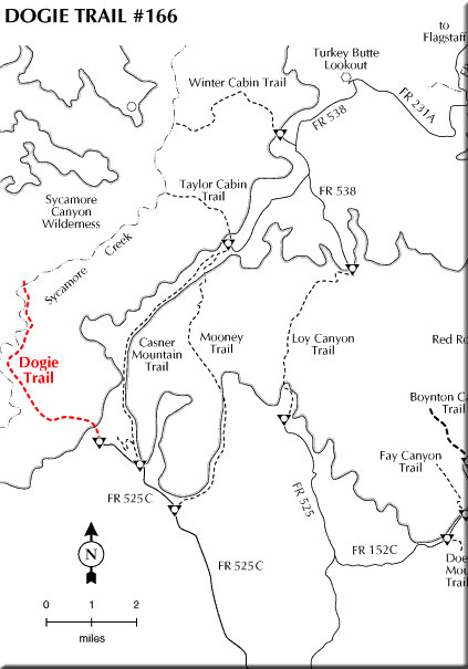
The Dogie Trail offers hikers and horsebackers a chance to experience one of Arizona's spectacular views without all of the crowds. If solitude is what you seek, this could be the trail for you. The trail descends into the heart of the Sycamore Canyon Wilderness. For those who long for rugged beauty unspoiled and untamed by man, Sycamore is one of the few paces in the southwest that can lay claim to such a lack of man's accomplishments. The trail into this primitive area begins at a saddle 200 yards from where you should park your vehicle. Expect a panoramic view of the canyon from this pass.
Javelina, deer, quail, and numerous other animals call this country home. Pinyon pine, juniper, Arizona cypress, brush fields and wildflowers are abundant.
Make sure you take lots of water for this hike especially during late spring to early fall months. Temperatures quite often exceed 110 degrees in the canyon bottom.
Rating: Moderate to strenuous
Hiking time: Plan on a full day/overnighter
Notes:
No motorized or mechanized vehicles (including bicycles) in Wilderness
Very hot during summer months.
It is 5.4 miles to canyon bottom and Sycamore Canyon Trail
At a Glance
Open Season:
Year 'round
Usage:
Light
Closest Towns:
Sedona, AZ
Operated By:
Red Rock District - 928-203-2900
General Information
Directions:
USGS Maps: Loy Butte, Sycamore Basin
Location: About 50 miles south of Flagstaff (14 miles west of Sedona) on paved and graveled roads.
Access: Drive 30 miles south from Flagstaff through Sedona on US 89A. Five miles past Sedona turn north on FR 525 and follow the signs to Sycamore Pass. Turn west on FR 525C and continue for nine miles to the parking area. Hike road up to the saddle.