Wide and nearly level, Long Canyon Trail provides easy access into Sedona's scenic red rock backcountry. For the first mile or so, the route follows an old jeep trail up an ephemeral streambed. Though this drainage is usually dry, it still supports a community of riparian or water-loving vegetation. Along the trail you'll even find a number of cypress trees, Arizona cypress, which are easily recognizable by their shaggy bark and round, gum ball-size seeds.
Providing a scenic setting for this unique habitat are a sampling of the picturesque buttes and cliffs for which the Sedona area is so famous. Steamboat Rock, Wilson Mountain, Maroon Mountain, and a number of unnamed cliffs, spires, windows and arches are visible from this trail. The trail ends at a red sandstone cliff where there are a few small Indian ruins and some primitive rock pictographs. Please don't disturb them.
See also Deadmans Pass Trail and Boynton Canyon Trail
Rating: Easy
Hiking time: 3 hours
Notes:
No motorized vehicles, No Bikes
At a Glance
Fees
Red Rock Pass (minimum $5.00) or any America The Beautiful or valid Golden Pass.
Open Season:
Year 'round
Usage:
Medium
Closest Towns:
Sedona, AZ
Operated By:
Red Rock District - 928-203-2900
General Information
Latitude: 34.9071
Longitude: -111.8241
Length: 3 miles
Elevation: 4520 at trailhead
General Notes:
Directions:
USGS Maps: Wilson Mountain
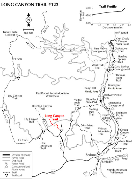
Location: About 32 miles south of Flagstaff (2 miles west of Sedona) on paved roads. The elevation ranges from 4560 to 5000 feet.
GPS: N34° 54' 23.976", W-111° 49' 27.1914"
Access: Drive 27 miles south from Flagstaff on US 89A through Sedona to Dry Creek Road. Turn north (right) about a mile and a half to Long Canyon Road (FR 152D) and north (right) again about 0.5 miles to the Long Canyon trailhead on left.