This is a good trail that climbs gently for .2 miles to the base of the low mountain, then bends to the left and begins a moderately steep climb up the east flank and onto the basaltic lava of this old volcano. Nice views. The trail turns right (west) into a small drainage and continues to climb, emerging on a low saddle at .5 miles where it intersects a north/south trail. Turn right (north) and follow the path as it climbs gently for .25 miles to the mountain's high point. Go a bit further to the edge for great panoramic views.
Return to the junction with the upcoming trail. For more great views, continue ahead for 50 yards to a well-defined fork. The right branch crosses the top of the mountain and drops down to Lower Red Rock Loop Road. Take the left fork (east) which gently climbs, ending after .33 miles on a point of land among large basalt blocks. This vantage point offers wonderful views all around. Return by the same route. This trail is unshaded and can be hot in summer.
The elevation at the trailhead is 4,450 feet. The high point is 4,800 feet, a gain of 350 feet.
Rating: Easy
Uses: Hiking, horseback riding, bicycles
Hiking time: allow 2 hours roundtrip
At a Glance
Open Season:
Year 'round
Operated By:
Red Rock District - 928-203-2900
General Information
Latitude: 34.846220
Longitude: -111.828555
Length: 1 mile
Elevation: 4450 at trailhead
Directions:
USGS Map: Sedona
Location: 28 miles south of Flagstaff on paved and dirt Forest roads in scenic red rock country.
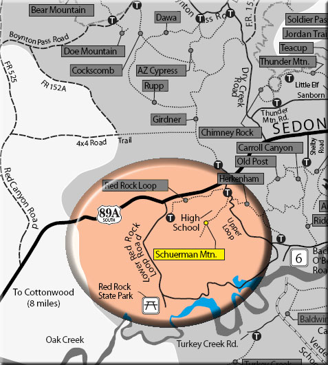
Access: From the junction of Routes 89A and 179, take 89A west 4.2 miles to the traffic signal at Upper Red Rock Loop Road. Turn left and go .25 miles, passing the high school and turning onto the third driveway to the right. go 50 yards to marked trailhead parking.