The White Mesa Trail starts on the west side of Casner Canyon with Casner Butte Visible on the east side of the drainage. The Casners were a family who homesteaded on the south side of Wet Beaver Creek in the 1870s and have several landforms in the Verde Valley named after them. The trail enters the Wet Beaver Wilderness (closed to the use of motorized equipment and mechanized transport, including bicycles) and passes through typical upper Sonoran vegetation, consisting of prickly pear, agave, and juniper.
The intermittent flow of water in Casner Canyon has exposed several of the geologic layers found in many of the canyons of the colorado Plateau. The pinkish-colored rock layer seen at the bottom of the canyon is part of the Supai Formation, deposited over 250 million years ago. Overlying the Supai Formation are the Toroweap Formation, Coconino sandstone, and the Kaibab Formation. Basaltic flows from volcanic activity to the north are visible as the top layer.
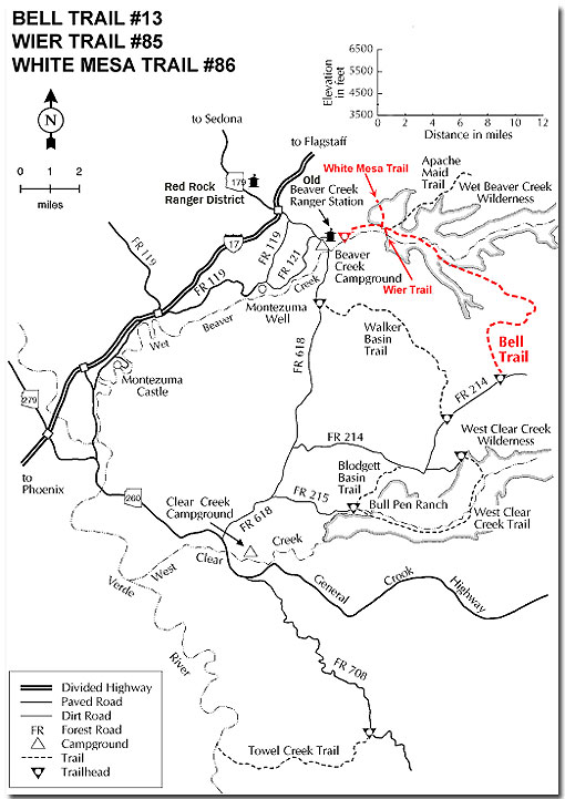
The trail gently ascends the west side of the canyon and ends near the gate. A short hike from the gate to the top of White Mesa provides a panoramic view of the surrounding area. Apache Maid Mountain can be seen to the east; the San Francisco Peaks are visible to the north; to the west is the Red Rock country of Sedona; and to the southwest are the Black Hills. For those with orienteering skills a loop hike may be made by following the rim of Casner Canyon to its head and hiking due south to connect with the Apache Maid Trail #15. A topographic map and compass are recommended for the loop hike. Be sure to take plenty of water for your hike as none is available on the trail.
Rating: Moderate
Hiking Time: 1 hour
Notes:
No motor vehicles, no mechanized vehicles in the Wilderness.
White Mesa Trail provides the shortest, easiest access from the canyon of Wet Beaver Creek to the mesa tops, which form part of the Mogollon Rim.
Location: 43 miles south of Flagstaff on paved and all-weather graveled roads.
Access: From I-17 turn east at exit 298. Go approximately 2 miles to FR 656. Turn left and drive the the parking lot. Hike 2 miles to the junction of Bell Trail and the Wier Trail.